Basic Information
Observation Details
Observation Date:
December 28, 2022Submitted:
December 28, 2022Observer:
Geoff Unger | Key ObserverZone or Region:
Mammoth LakesLocation:
Mammoth Lakes BasinSigns of Unstable Snow
Recent Avalanches?
YesCracking?
IsolatedCollapsing?
None ExperiencedSnow Stability
Stability Rating:
FairConfidence in Rating:
ModerateStability Trend:
ImprovingKey Points
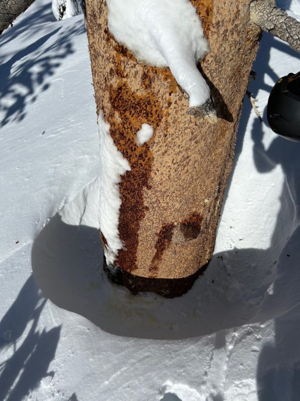
Touring in the Lakes Basin today proved rewarding for snow conditions, snowpack observations and avalanche observations. See additional posts for avalanche observations in a variety of locations. One thing of note lower down was intense snow loading on the lower half of trees in the forest and stripping on the top half. This must be due to wet snow, but also extreme winds.
- Signs of instability were not evident in the trees, but evidence of recent avalanches were visible in many locations.
- Lower in the basin today winds were light to calm, but wind transport was visible at ridge top.
- Sheltered areas didn’t seem to be impacted by solar radiation, but exposed southerly aspects were starting to see some warming.
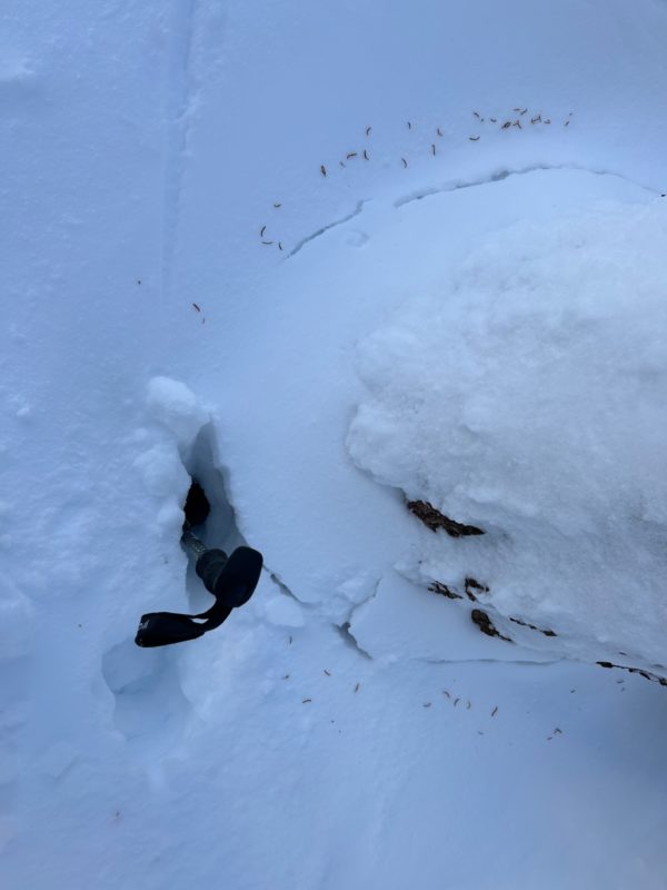
- Previously tree wells that were open to the ground or a little tighter, but have now been refilled or pillowed with soft unsupportable snow.
- Though there was a window of improving stability today, new snow in the forecast will change everything tomorrow.
Media


Advanced Information
Weather Summary
Cloud Cover:
Mostly SunnyWind:
Light , SW
Crisp in the morning, with warming in the afternoon. Light winds from the SW going calm in the afternoon. Flagging was visible at ridge top for a good portion of the day, but dwindled in the late afternoon.
Snowpack Observations
We performed a series of surface snowpack observations on test slopes and unsupported features below treeline. It took significant effort to get cohesive snow to move as a unit. This was consistent in hand shear tests as well. The common element of the cohesive slabs was the impact of wind that stiffened the snow surface and increased depth of the slab.

