Basic Information
Observation Details
Observation Date:
January 19, 2023 - January 19, 2023Submitted:
January 19, 2023Observer:
Clancy Nelson | ESAC ForecasterZone or Region:
June LakeLocation:
Chicken Wing - Small Sensitive Wind SlabsSigns of Unstable Snow
Recent Avalanches?
YesCracking?
IsolatedCollapsing?
None ExperiencedKey Points
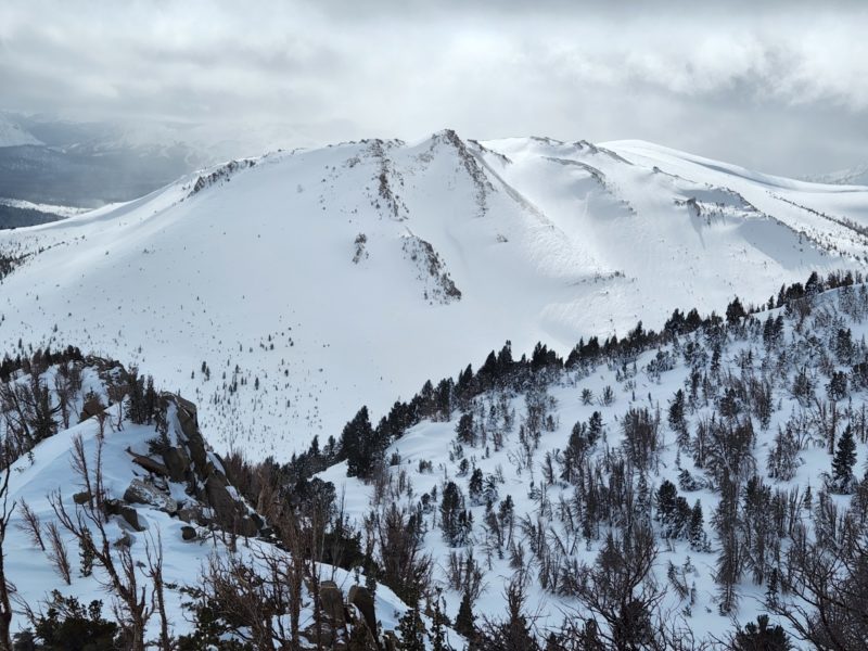
I got out for a short tour to test wind slabs near treeline in the northern half of the forecast area.
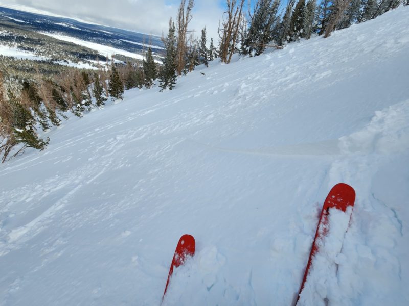
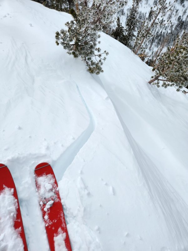
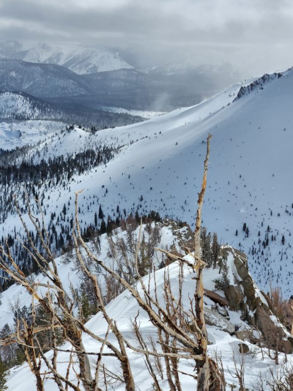
- I intentionally triggered a few small wind slab avalanches, shooting cracks, and small cornices on north and northeast-facing test slopes at the summit. Other east and southeast-facing slopes were stubborn. North winds just began stripping northerly slopes as I headed down around 1pm. Before that time, south and west aspects were stripped or sheltered from the wind. No wind slabs on those aspects.
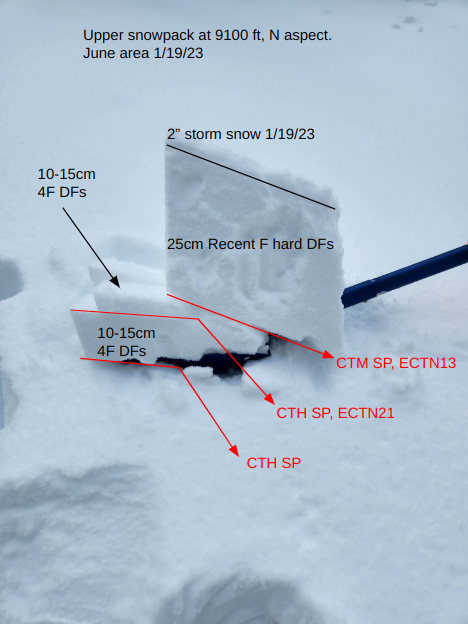
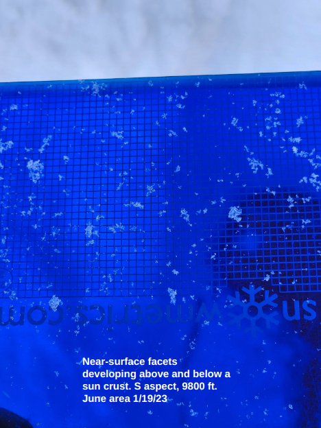
- No sluff or storm slab instabilities in sheltered terrain below treeline. I dug a test pit to look at the upper snowpack. (See shovel tilt test photo.) I did not find persistent weak grains in the upper pack or under the new snow except near the summit on a south-facing slope where I saw small near-surface facets forming above and below a sun crust at the surface. It was easy to tell sheltered terrain not just because of the snow still in the trees and lack of wind, but because there where big beautiful stellar dendrites (that’s geek for snowflakes) on the surface. With cold high pressure in the forecast, there’s a lot of low density snow to facet at the surface. I consistently found temperature gradients in the top 20cm more than strong enough to drive that process.
- The storm moved from north to south across the mountains. On my drive up from Bishop it was mostly clear with little blowing snow until Mammoth. From Mammoth north is was snowing lightly (S-1) and there was moderate to intense blowing snow at all elevations down to the side of 395. On my drive back in the afternoon, it was clearing as I headed south to Mammoth. Then it was snowing and I saw blowing snow at all elevations south into Bishop Creek.
Media
Advanced Information
Weather Summary
Cloud Cover:
Mostly CloudyTemperature:
Single digits with a high of 17 at 8000 ft at 1pmWind:
Moderate , NW
8000 ft, NE aspect, slope: 2 degrees at 10 am: HS 245 cm. Ski pen: 25, boot pen: 55. S-1. L NW wind. Prev blow snow. BKN sky. Surface forms: F hard wind broken. Tair -14C. Tsurf -10C. T20 -15C. HN 2in.
9100 ft, N aspect sheltered trees, slope: 21 degrees at 11:15 am: HS >3 m. BKN. L N wind. Ski 25. Boot 70. S-1. Surface form: F hard PP. Tair -13C. Tsurf -14C. T20 -16C. HN 2in. Hasty Pit here, see photo.
9800 ft, NE aspect at the summit, slope: 23 degrees at 12:30 pm: BKN. M NNW wind and M blowing snow. Ski 16. Boot 25. Surface forms: 4F wind packed. S-1. Tair -16C.
8000 ft, NE aspect, slope: 2 degrees at 1:15 pm: Clearing. BNK/partly sunny. Calm wind. No precip. Tair -10C.
Avalanche Observations
| # | Date | Location | Size | Type | Bed Sfc | Depth | Trigger | Comments | Photo |
|---|---|---|---|---|---|---|---|---|---|
| 2 | Today |
Top of Chicken Wing N 9700 ft |
D1 | HS | I-New/Old Interface | 15 cm |
AS-Skier c-Intentional |
None |
