Basic Information
Observation Details
Observation Date:
March 15, 2022 - March 15, 2022Submitted:
March 15, 2022Observer:
Geoff Unger | Key ObserverZone or Region:
Mammoth LakesLocation:
Lookers left of Mammoth RockSigns of Unstable Snow
Recent Avalanches?
YesCracking?
None ExperiencedCollapsing?
None ExperiencedWarming occurred as the the day progressed with additional loading of low elevation terrain with a rain on snow event.
Snow Stability
Stability Rating:
GoodConfidence in Rating:
HighStability Trend:
WorseningKey Points
As we move toward spring it is common to think about Wet Loose avalanches on E-SE-S-SW-W aspects, but we are not there yet. With heavy, wet snow and rain falling it is more likely to weaken the relatively softer surfaces on North Aspects before impacting the Southerlies. That was the case today in the Sherwins. With rain on snow the snowpack surface weakens quite quickly. What happens next depends on temperatures the next series of days. One outcome can be a refreeze and reset, catapulting us to spring diurnal cycles. On the other hand, we could have soupy surface snow the next few days if temperatures stay above freezing overnight.
Advanced Information
Weather Summary
Cloud Cover:
ObscuredWind:
Moderate , SW
The weather was in and out today with a variety of precipitation types: Rain, Rain Snow Mix and Snowfall. Winds were moderate with strong gusts from the Southwest. Skies were obscured for much of the day.
Avalanche Observations
| # | Date | Location | Size | Type | Bed Sfc | Depth | Trigger | Comments | Photo |
|---|---|---|---|---|---|---|---|---|---|
| 2 | Today |
Mammoth Rock/Poop Chute Area NE 8000 |
D1 | L | 5cm | N-Natural |

|
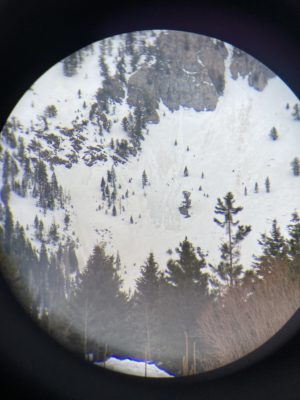
Spotted these few Wet Loose Avalanches from the road after leaving the field. These are distinct from older fans nearby given the slightly darker definition of the tracks and the debris. Likely these were caused by weakening of the surface snow from rain.
Snowpack Observations
With the precipitation today snow surfaces were wet and gloppy at low elevations. Ski penetration was 10-15cm. Boot pen was similar in areas where the wind had previously stiffened the surface. Elsewhere the underlying snowpack was faceted and unsupportable, especially near trees, rocks and slabs. In these areas you could find yourself wallowing up to your waist as soon as you stepped out of your skis.
