Basic Information
Observation Details
Observation Date:
December 26, 2022Submitted:
December 26, 2022Observer:
Geoff Unger | Key ObserverZone or Region:
Mammoth LakesLocation:
Reds Lake ShoulderSigns of Unstable Snow
Recent Avalanches?
None ObservedCracking?
None ExperiencedCollapsing?
None ExperiencedIt was feeling pretty locked up out there with limited warming and barely visible wind transport. All eyes are on the new rain and snow to come.
Snow Stability
Stability Rating:
GoodConfidence in Rating:
HighStability Trend:
SteadyKey Points
Today was a better day to be a forecaster than a skier. The facet skiing that was holding in the sheltered trees didn’t hold as well with cloud cover and limited rewarming today. Exploration of mid elevation solars also yielded underwhelming results. On the plus side we got a chance to dig a snow profile and practice some snow science craft.
Advanced Information
Weather Summary
Cloud Cover:
Mostly CloudyTemperature:
6.0 degrees CWind:
Light , SW
The weather started off cloudy as was expected, but the clouds were in and out as opposed to increasing cloud. The winds we expected to see also held off until after we were out of the field. Tonight seems to be the change over to inclement weather.
Snowpack Observations
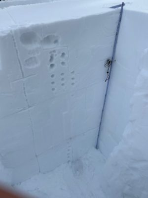
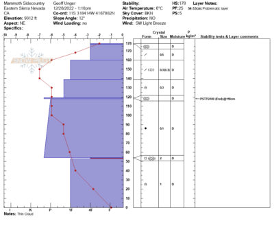
We dug a snow profile on a NE aspect at 9300 feet. Snow depth was 178cm. Targeted observation was the bonding between our strong mid-pack and basal facets. We performed 2 deep tap tests on the interface at 53cm. After that we did a practice PST on an upper layer that was easy to identify. This seemed a better option since we didn’t have results that would indicate fracture initiation on the lower facet layer.


