Basic Information
Observation Details
Observation Date:
January 1, 2023 - January 1, 2023Submitted:
January 1, 2023Observer:
Clancy Nelson | ESAC ForecasterZone or Region:
Rock CreekLocation:
Red Mountain - Natural Avalanches, Soft Wind Slabs, Wet Basal FacetsSigns of Unstable Snow
Recent Avalanches?
YesCracking?
IsolatedCollapsing?
IsolatedKey Points
Took a quick tour to near treeline terrain on the north shoulder of Red Mountain to look for recent storm instabilities and see how deeply the snowpack was wet.
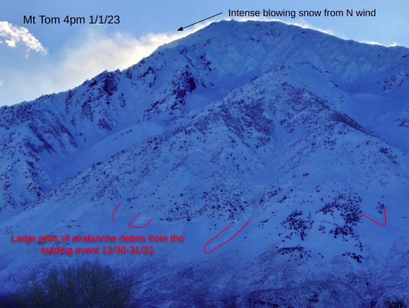
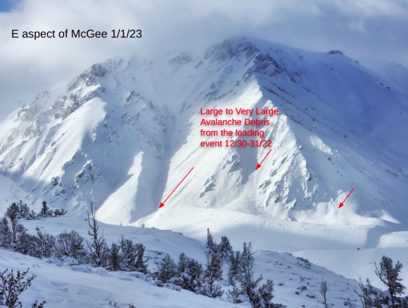
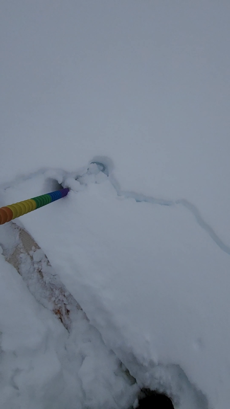
- We saw debris piles from large to very large recent avalanches on surrounding peaks. (See photos)
- We had wind-stiffened soft slabs occasionally crack and break around us. These were thicker, harder (4F), and more widely distributed above about 8,500 feet where the trees are small and open. They were from 2 to 12 inches thick.
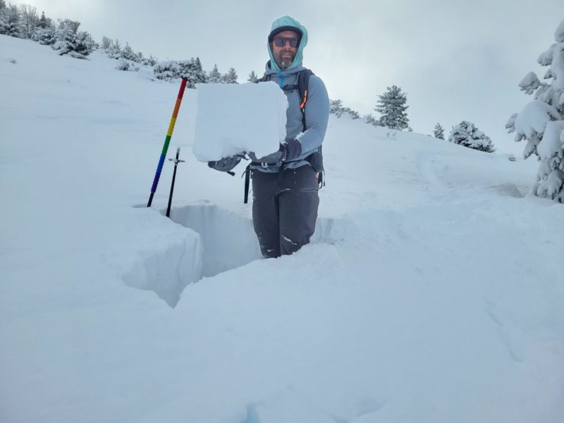
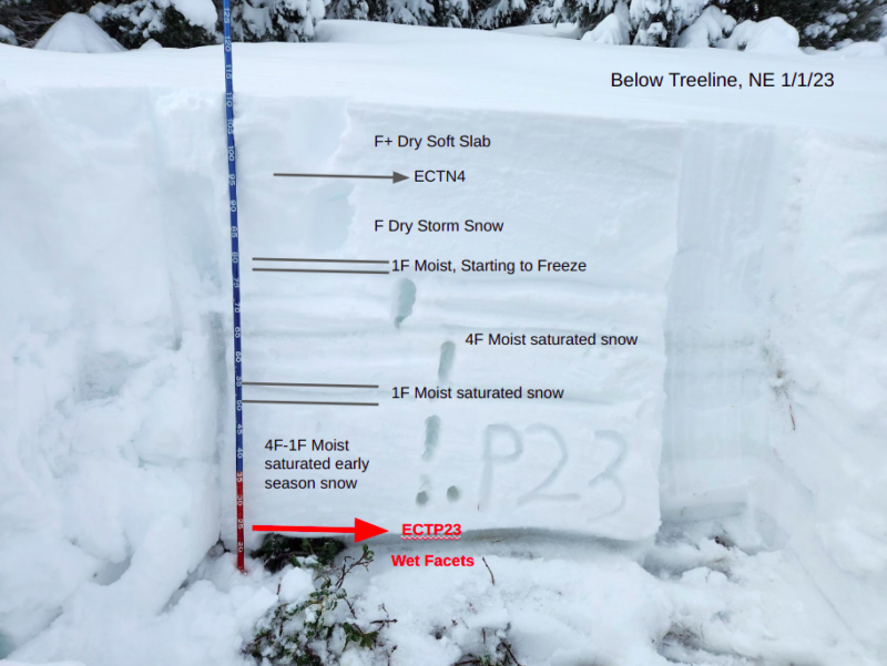
- We got localized collapsing and cracking around us below treeline. Some of this was sage collapsing, some of it was failure in wet facets at the base of the snowpack. We dug at 8,100 feet on a northeast-facing slope and found 45cm of soft dry storm snow atop moist to wet saturated snow to the ground. The very top of the moistened older snow was just starting to freeze into a crust under the dry storm snow. We got propagation in wet facets at the bottom of the snowpack. (See photo)
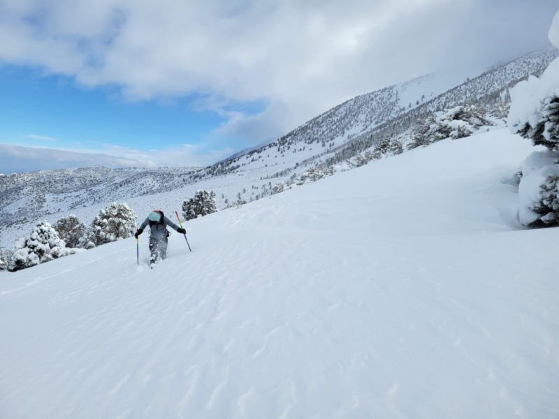
- New dry storm snow totaled 30cm at 7,500 feet and steadily increased to 45-50cm above 8,000 feet. The top 15cm was slightly wind-stiffened. HS was 80 to 110cm near and below treeline. Boot penetration averaged between 60-80cm.
- North winds were cranking at ridgetops and we saw intense blowing snow above treeline stripping typically leeward slopes. There was also some blowing snow along the 395 corridor.
We stuck to slopes less than 30 degrees with little overhead hazard which reduced our exposure to the avalanche problems. We frequently “fell through” wind slabs or augured in. Travel was difficult.
Media
