Basic Information
Observation Details
Observation Date:
January 2, 2023Submitted:
January 2, 2023Observer:
Everett Phillips | ESAC ForecasterZone or Region:
Lee ViningLocation:
395 June Lake to Lee Vining - Avalanche Obs (Photos)Signs of Unstable Snow
Recent Avalanches?
YesCracking?
None ExperiencedCollapsing?
None ExperiencedAdvanced Information
Weather Summary
Cloud Cover:
Partly CloudyTemperature:
Not ObsWind:
Light , W
Blowing snow above treeline visible from Highway 395 on the high peaks between June and Lee Vining.
Avalanche Observations
| # | Date | Location | Size | Type | Bed Sfc | Depth | Trigger | Comments | Photo |
|---|---|---|---|---|---|---|---|---|---|
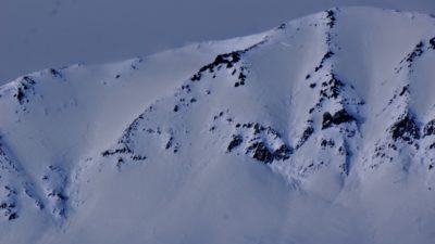
| 2 | Past 48 hours |
Mt Wood E 12000' |
D2.5 | N-Natural |
|
||||
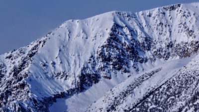
| 1 | Past 48 hours |
Mt. Lewis E 11600' |
D3 | N-Natural |
|
||||
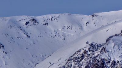
| 1 | Past 48 hours |
Mount Gibbs - East aspect of S. Ridge E 11,900' |
D2.5 | N-Natural |
|
||||
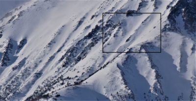
| 3 | Past 48 hours |
Peak 12565 (Gibbs N. Shoulder) E 11,500' |
D2 | N-Natural |
|
||||
| 3 | Past 48 hours |
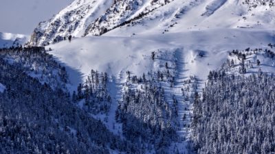
East Peak, at treeline, top of lower bench NE 9000' |
D2 | N-Natural |
|
||||
| 3 | Past 48 hours |
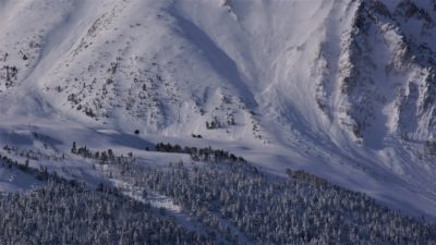
East Peak - Toe of NE Butress NE 10,300' |
D2 | N-Natural | Multiple large natural avalanches NTL and debris from avalanches running from ATL start zones. |
|
|||
| 1 | Past 48 hours |
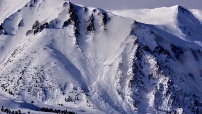
ATL East Peak, Lee Vining E 11,300' |
D3 | N-Natural | Obvious debris out of the funnel shaped start zones in the center of photo. There is a possible crown line of a v. large avalanche in the shadows on the right margin of the photo half way up the frame. |
|
Numerous crown lines and debris piles from large and very large avalanches were visible on the drive from June Lake to Lee Vining. The evidence was already partly re-filled by blowing snow and snowfall, so it seems likely that these avalanches occurred during the peak of the last storm on New Year’s Eve. This is more of an educated guess than confirmed data, but the depth and shape of the crown lines (irregular and wide propagation) suggest that some of these avalanches failed on weak layers in the old snow (persistent slab avalanches). Hard to know for sure from a distance and with blowing snow obscuring the details.
Avalanche Problems
Blowing snow on ridgelines in most of the photos points to the main concern today (20230102) – fresh wind slab formation ATL and NTL.
Close